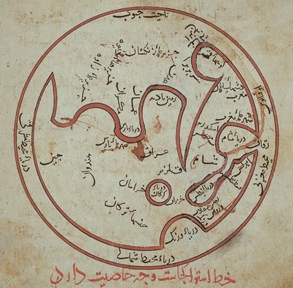
creating an accurate mapBiruni was regarded as the most skilled in mapping cities and measuring distances between them. He did this for cities the Middle East and the Indian subcontinent. By combining astronomy and mathematical equations, and recording degrees of latitude and longitude, he developed methods to pinpoint locations on the map. He also developed similar methods to measure the heights of mountains and depths of valleys, while also discussing human geography and planetary habitability of the Earth. |
|
|